Baptista Boazio's Irlandiæ c. 1606 = Irlandiæ accvrata descriptio - UCD Digital Library

Baptista Boazio's Irlandiæ c. 1606 = Irlandiæ accvrata descriptio

Baptista Boazio's Irlandiæ

Irlandiæ accurata descriptio

In collection Historic Maps of Ireland from the Library of Congress

Origin information
Antwerp : A. Ortelius
Date issued:
Type of Resource
cartographic
Physical description
1 item ; 5.301371 MB (image/jp2) — Reformating quality: preservation
Static display versions in JPEG format in three sizes are available.
Ingested from the Library of Congress on 2011-10-22: http://memory.loc.gov/gmd/gmd5/g5780/g5780/ct000403.jp2
Note
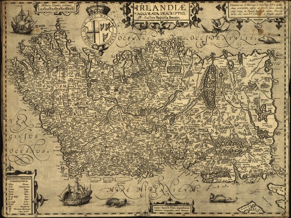
Relief shown pictorially.
Note
Oriented with north to the right.
Note
Available also through the Library of Congress Web site as a raster image.
Map scale
Scale [ca. 1:2,250,000].
Languages
lat  
Genre
Map
Ireland--Maps--Early works to 1800
Location
Library of Congress Geography and Map Division Washington, D.C. 20540-4650 USA
Location
http://hdl.loc.gov/loc.gmd/g5780.ct000403


Rights & Usage Conditions